
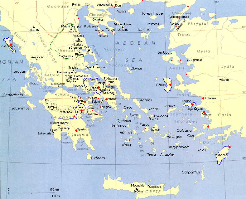
Ancient Greece Map Project Greek civilization developed on dry, rocky lands surrounded by water. Most of Greece consists of a large peninsula, however the seas surrounding Greece also contain hundreds of small islands. Ancient Greece's unique geography made it a crossroads for travelers and traders who exchanged goods, ideas, and customs. Today you will have the opportunity to make a detailed map of Ancient Greece, featuring important regions, cities, bodies of water, islands, and other land forms. You can find directions for the assignment here. A blank outline of map of Ancient Greece is here (please make a copy and put directly into your name folder within your Social Studies folder). A sample map is here. Additionally, to help you complete the project, a collection of maps of Ancient Greece from the British Museum can be found here. A detailed map of Ancient Greece has also been posted below. You are also welcome to conduct your own independent research to help you complete your map.


No comments:
Post a Comment